Case study · decided file
The Committee Approves Six Townhouse Lots on The Queensway
598 The Queensway · consent to sever into six lots with easements · approved 2024
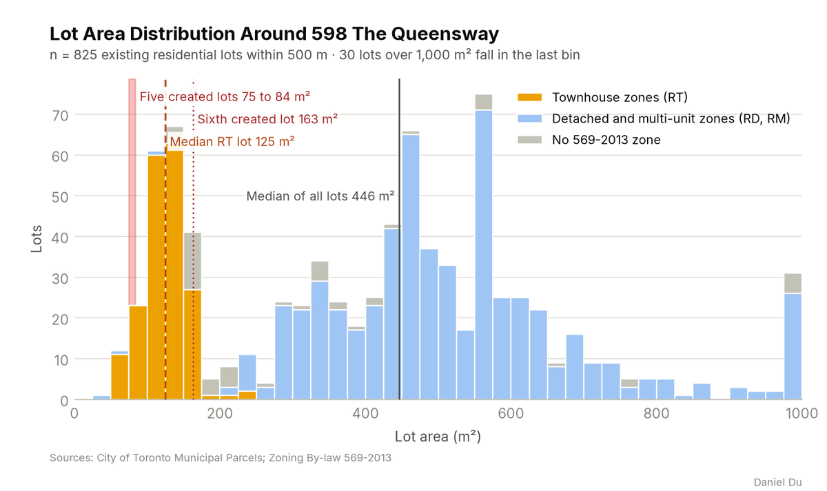
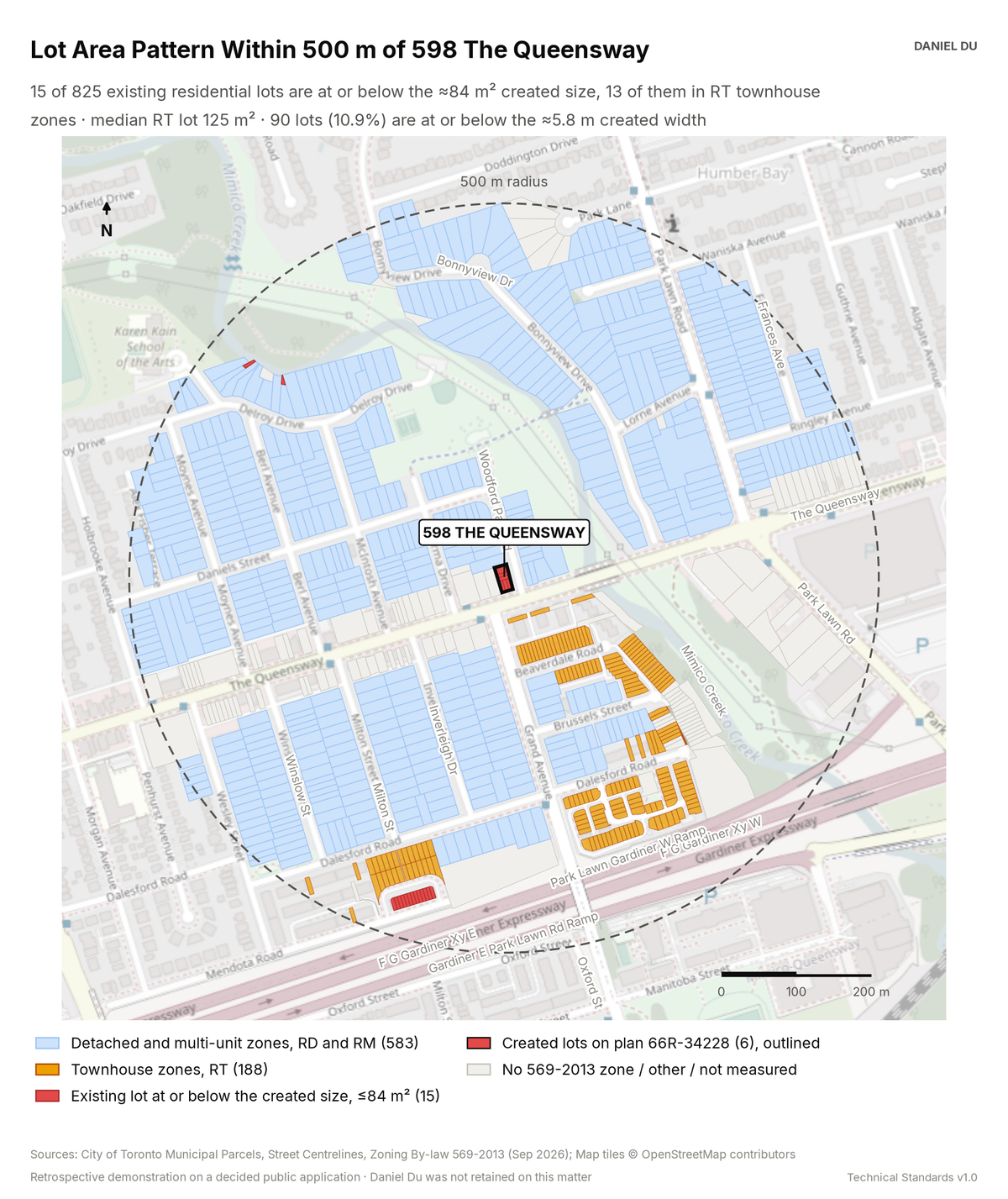
The six created lots measure 74.8 m² to 163.0 m². The fabric within 500 m already holds 188 townhouse lots with a median of 125 m², so the created lots join an existing pattern.
This is a retrospective demonstration study. The Committee of Adjustment already decided this application, and the file is a public record. Daniel Du was not retained on the matter. We prepared this analysis after the decision, as a work sample. It states no planning opinion.
The package includes the report (PDF), print-ready map and chart exhibits (PNG), the data tables with a data dictionary (CSV), a methods note (TXT), the interactive map (HTML).
The interactive map is one HTML file. Open it from disk in any browser. Each threshold has a slider and an exact-value box, and the counts and headline update as you move them. You can change the colours, outlines and fill, switch to a colour gradient, or add a satellite, topographic or building footprint background. Click any mapped feature to see its record. The map works offline. The satellite and topographic backgrounds need an internet connection. The package also includes this same file.
How it is measured
The parcel fabric already reflects the registered severance. We therefore measure the created lots as they now stand, and we do not reconstruct the parent parcel. The subject address returns two parcels. All six created lots share reference plan 66R-34228, effective 21 August 2025, so we gather them by plan name. We identified six parcels on that plan. Five are townhouse lots of 75 to 84 m². The sixth is a 163 m² lot at 6 Woodford Park Rd. The decision record does not say which lot carries the right-of-way easements. We use the union of the six parcels as the subject geometry.
We measure every addressed residential parcel within 500 m from parcel geometry in EPSG:2952. We keep parcels in RD, RT and RM zones and parcels with no 569-2013 zone. We exclude 27 parcels in commercial, employment and open space zones, and we exclude the six created lots. We apply no lower area floor, because the townhouse lots this study is about fall below the usual 80 m² floor. Frontage is the street-facing edge of the lot, projected along the street. For the created lots we report width as the short side of the minimum rotated rectangle, because the corner lot at 598 The Queensway returns its long side as street frontage.
The created size thresholds are the largest of the five small created lots, 84 m² and 5.8 m. A lot counts as at or below the created size if it is within 0.05 of that value.
No 569-2013 zone polygon joins to the subject parcels. We report that absence as a finding. The surrounding fabric is covered, mostly by RD (f13.5; a510; d0.45), several RT exception zones and RM (u4) (x18).
Consent precedent comes from Committee of Adjustment records since 2015. We geolocate each record to the parcel fabric. We count the lots created from the record field where it is filled, and from the application description where it is not. The open record is thin before 2015, so the precedent counts are conservative.