Case study · decided file
The Committee Approves 185 Rental Units on Victoria Park
1925 Victoria Park Ave · 12-storey mixed-use building with 185 rental units · approved 2025
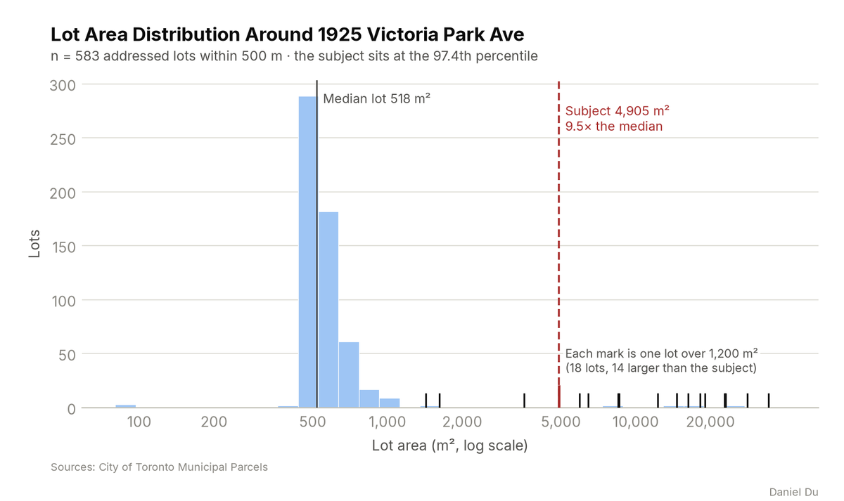
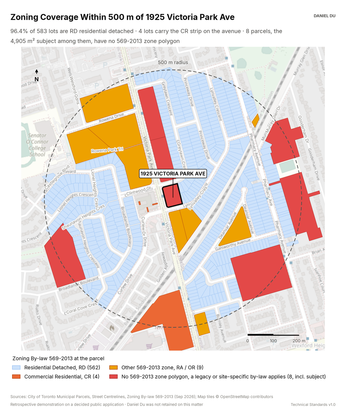
The site measures 4,905 m², which is 9.5 times the median lot nearby. Zoning By-law 569-2013 maps no zone on the site itself, although it covers 96.4% of the lots around it.
This is a retrospective demonstration study. The Committee of Adjustment already decided this application, and the file is a public record. Daniel Du was not retained on the matter. We prepared this analysis after the decision, as a work sample. It states no planning opinion.
The package includes the report (PDF), print-ready map and chart exhibits (PNG), the data tables with a data dictionary (CSV), a methods note (TXT), the interactive map (HTML).
The interactive map is one HTML file. Open it from disk in any browser. Each threshold has a slider and an exact-value box, and the counts and headline update as you move them. You can change the colours, outlines and fill, switch to a colour gradient, or add a satellite, topographic or building footprint background. Click any mapped feature to see its record. The map works offline. The satellite and topographic backgrounds need an internet connection. The package also includes this same file.
How it is measured
We measure every addressed lot within 500 m from parcel geometry in EPSG:2952. Lot area is the parcel polygon area. We compare the subject with the full distribution of lot areas, including apartment and institutional sites. We report the subject's percentile and its ratio to the median. Corridor parcels and unaddressed parcels are excluded.
We read the zoning attribute for each parcel from the By-law 569-2013 Zoning Area layer. We group the ZN_STRING labels into four families: RD residential detached, CR commercial residential, other 569-2013 zones, and parcels with no 569-2013 polygon. The subject has no polygon. We report that plainly. The City's file record lists a former Scarborough designation instead.
Building heights are the City's LiDAR-derived values for the main building on each lot. We report the median, the maximum and the count above 15 m. We do not convert storeys to metres as a measurement. Where we quote a height for 12 storeys, we label it as an approximation.
The local record comes from Committee of Adjustment applications since 2015. We geolocate each record to the parcel fabric and normalize decisions. We flag a file as non-residential or mixed-use when its work type contains 'NR' or its description mentions mixed-use, commercial or storeys. We read the descriptions of flagged files and report the ones that describe house additions.