Case study · decided file
A Heritage House Becomes Apartments at Yonge and Bloor
66 Charles St E · heritage house converted to apartments · approved 2023
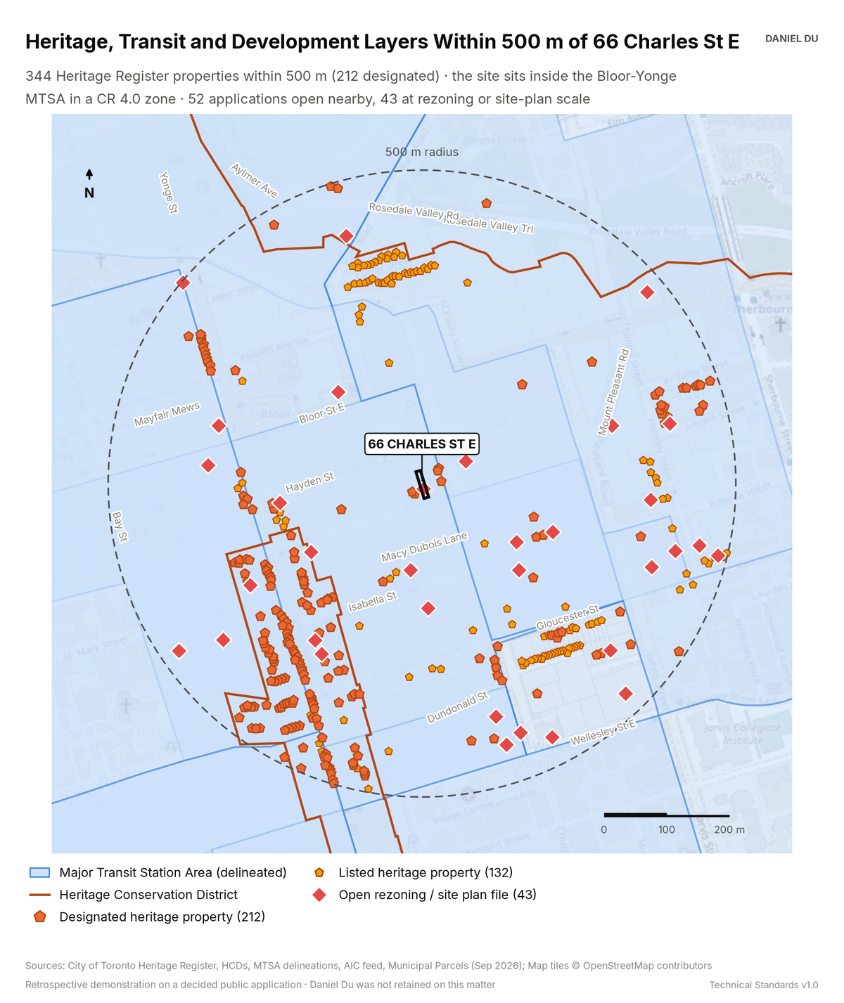
A 341 m² heritage lot carries CR 4.0 density inside the Bloor-Yonge MTSA. There are 344 register properties and 52 live applications within 500 m. The exhibit maps this policy, heritage, and application context.
This is a retrospective demonstration study. The Committee of Adjustment already decided this application, and the file is a public record. Daniel Du was not retained on the matter. We prepared this analysis after the decision, as a work sample. It states no planning opinion.
The package includes the report (PDF), the print-ready map exhibit (PNG), the data tables with a data dictionary (CSV), a methods note (TXT), the interactive map (HTML).
The interactive map is one HTML file. Open it from disk in any browser. Each threshold has a slider and an exact-value box, and the counts and headline update as you move them. You can change the colours, outlines and fill, switch to a colour gradient, or add a satellite, topographic or building footprint background. Click any mapped feature to see its record. The map works offline. The satellite and topographic backgrounds need an internet connection. The package also includes this same file.
How it is measured
We overlay Heritage Register points, Heritage Conservation District boundaries and the January 2026 MTSA delineations on the parcel fabric. We filter each layer to 500 m. Open applications come from the City's Application Information Centre feed. We deduplicate the feed to one point per application. We read the zoning attributes from the By-law 569-2013 Zoning Area layer at the parcel.