Sample study · Constraints as numbers
Archaeological Potential Study
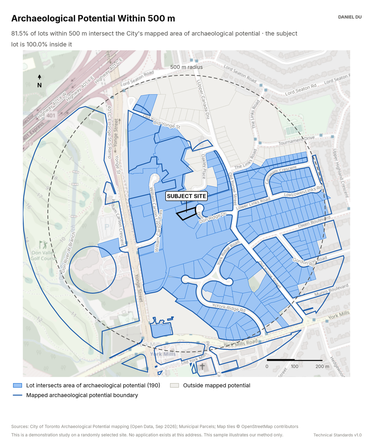
The study shows which lots the City's archaeological potential map touches. It states the assessment that each lot triggers.
Result on 23 Don Ridge Dr, Hoggs Hollow
81.5% of lots intersect mapped archaeological potential
The package includes the report (PDF), the print-ready map exhibit (PNG), the full data table with a data dictionary (CSV), a methods note (TXT).
How it is measured
We intersect the City's interim archaeological potential layer with the parcel fabric in EPSG:2952.
We report each lot's share inside the mapped area. We suppress overlaps under 2% as digitization noise.
Potential mapping is a screening layer. It triggers an assessment. It never prohibits development by itself.