Sample study · Policy and market context
Transit & MTSA Context Study
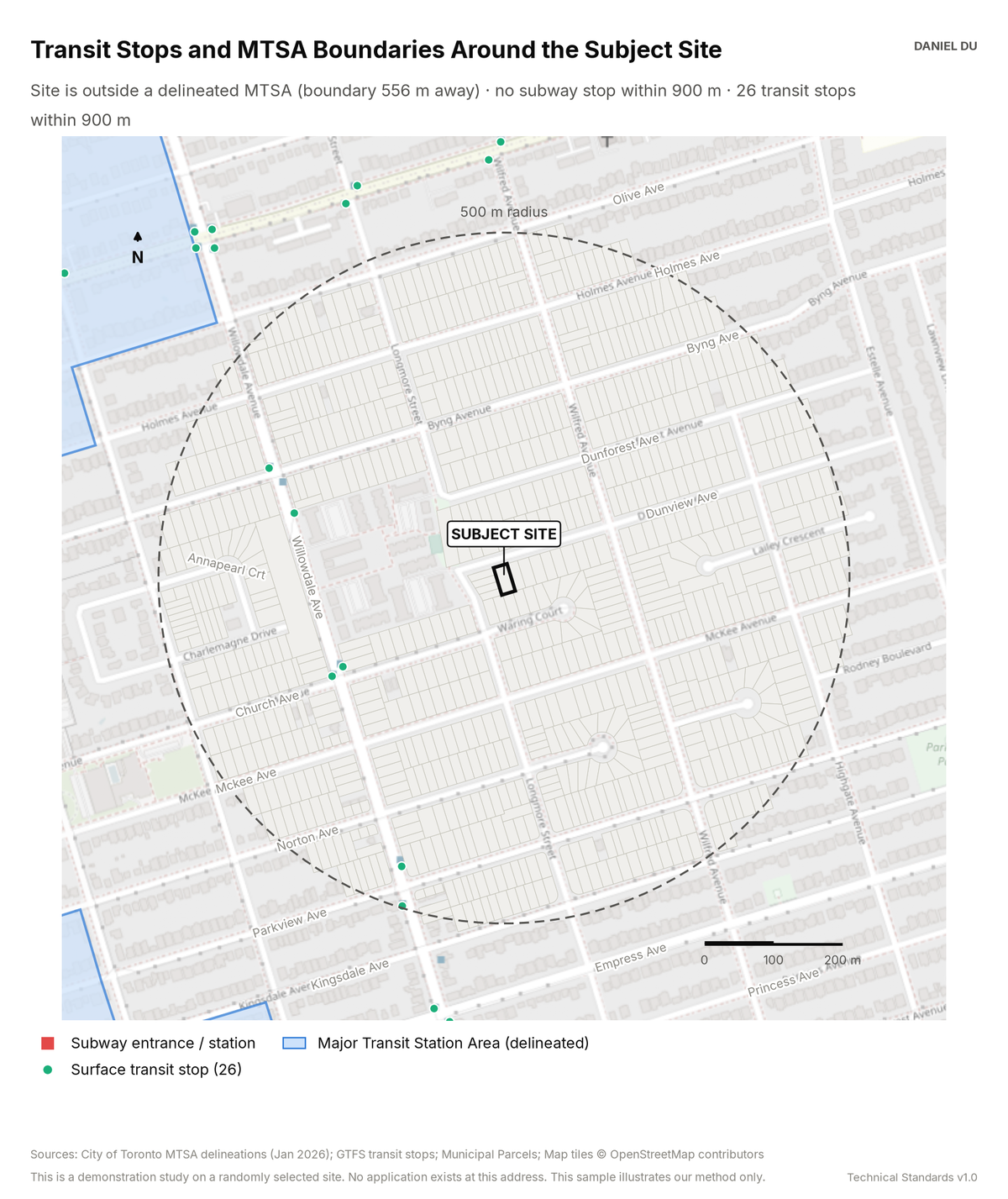
The study maps the delineated MTSA boundary. It measures the distance to each named transit stop. It does not use composite walk scores.
Result on 205 Dunview Ave, Willowdale
26 stops within 900 m; MTSA boundary 556 m from the demo site
The package includes the report (PDF), the print-ready map exhibit (PNG), the full data table with a data dictionary (CSV), a methods note (TXT).
How it is measured
MTSA polygons are the City's January 2026 delineations.
Stop locations come from GTFS data. We measure each distance as a straight line from the subject parcel centroid, computed in EPSG:2952.
Straight-line distances slightly understate walking distance. We state the direction of that bias so the number can be used with its limits known.