Sample study · Constraints as numbers
Ravine & Natural System Overlap Study
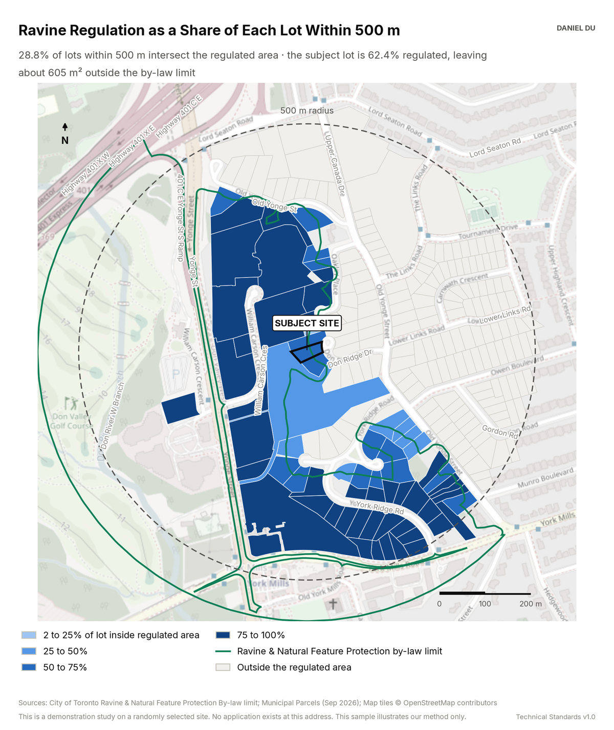
The study intersects the regulated area with every lot. It reports the result as a share and as developable square metres.
Demo site: 62.4% regulated, 605 m² outside the limit
The package includes the report (PDF), the print-ready map exhibit (PNG), the full data table with a data dictionary (CSV), a methods note (TXT).
How it is measured
The regulated area is the City's mapped Ravine and Natural Feature Protection by-law limit.
We compute each lot's overlap with the regulated area as an area intersection in EPSG:2952. We express the overlap as a share of the lot area.
We treat lots with an overlap under 2% as unregulated. This removes noise from boundary digitization.
The mapped limit is authoritative for screening. A survey locates the line for permit purposes.