Sample study · Neighbourhood character
Building Envelope Study
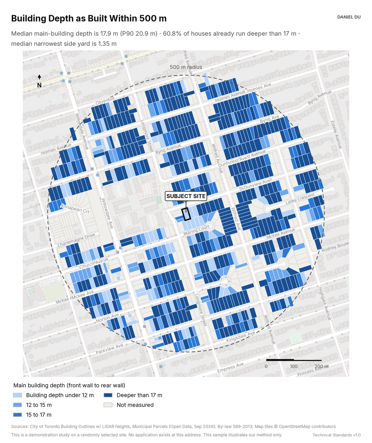
The study measures the depth, width, and side yards of every house in the radius.
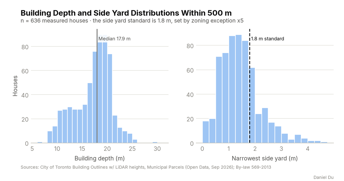
68.6% of houses stand closer to a side lot line than the current 1.8 m standard
The package includes the report (PDF), print-ready map and chart exhibits (PNG), the full data table with a data dictionary (CSV), a methods note (TXT).
The 2 km interactive map has the same controls and covers the full 2 km radius around the site.
How it is measured
We measure the main building on each mid-block RD lot in a lot-aligned frame. The frame is derived from the lot's street edge. Depth is the extent of the footprint away from the street. Width is its extent along the street. Side yards are the gaps to each side lot line. Values come from the City's LiDAR building outlines intersected with the parcel fabric in EPSG:2952. The by-law defines building depth and length as wall-based measures that exclude permitted encroachments. Footprint measures can therefore read slightly larger. We state this difference rather than hide it. The per-lot table permits survey-grade verification where a file turns on centimetres.