Sample study · General intent of the by-law
Site-Specific Relief Study
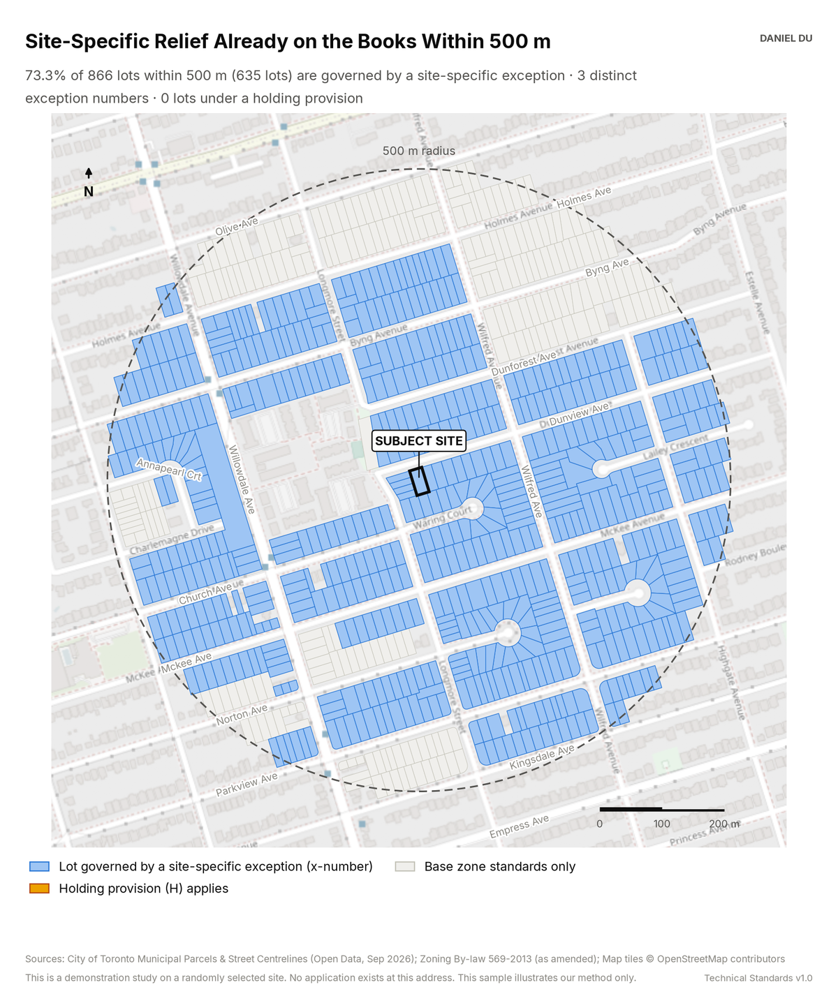
The study maps every lot under a Chapter 900 exception or holding provision. It quotes the relief granted for each lot.
73.3% of lots already carry a site-specific exception
The package includes the report (PDF), the print-ready map exhibit (PNG), the full data table with a data dictionary (CSV), a methods note (TXT), the interactive map (HTML).
The interactive map is one HTML file. Open it from disk in any browser. Each threshold has a slider and an exact-value box, and the counts and headline update as you move them. You can change the colours, outlines and fill, switch to a colour gradient, or add a satellite, topographic or building footprint background. Click any shaded lot to see its measured values. The map works offline. The satellite and topographic backgrounds need an internet connection. The package also includes this same file.
How it is measured
We read exception status from the zone label of the zoning polygon for each lot. The label carries a '(x n)' suffix and the EXCPTN_NO field. We read holding status from the ZN_HOLDING flag. Both fields are in the Zoning Area layer of By-law 569-2013. We resolve each exception number to its text in Chapter 900. The CSV carries a provision extract for each exception. A reader can therefore see the relief already granted as well as count it.
We exclude corridor parcels and unaddressed slivers. The count is of lots governed by an exception. It is not a count of exceptions. One exception commonly covers a whole subdivision plan.