Sample study · General intent of the by-law
Policy Layer Coverage Study
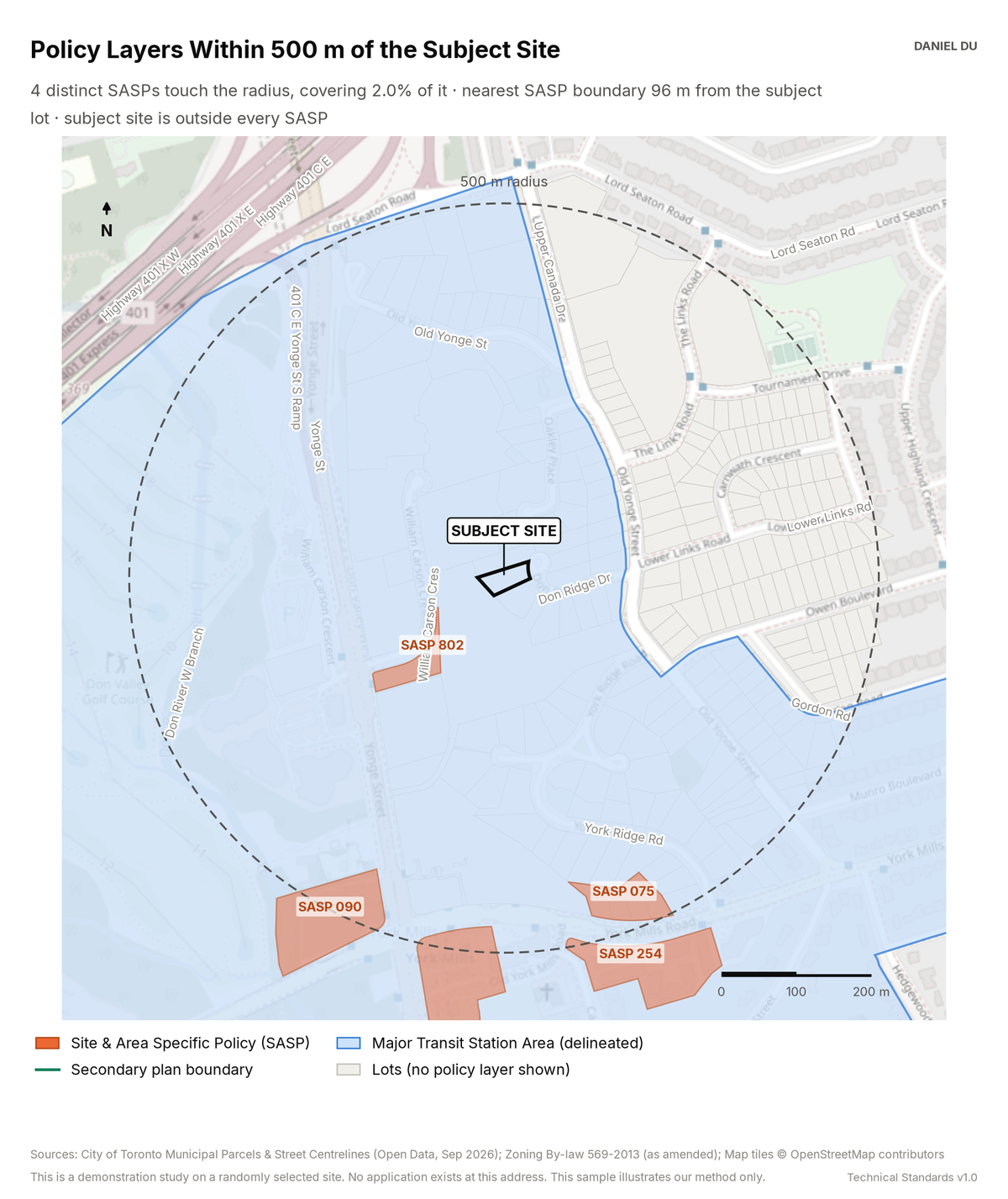
The study maps the SASPs, secondary plans, and MTSA boundaries in the radius. It extracts the policy text for each SASP.
Result on 23 Don Ridge Dr, Hoggs Hollow
4 SASPs within 500 m, nearest boundary 96 m from the site, which itself sits inside a delineated MTSA
The package includes the report (PDF), the print-ready map exhibit (PNG), the full data table with a data dictionary (CSV), a methods note (TXT).
How it is measured
We overlay SASP polygons, secondary plan boundaries and the January 2026 MTSA delineations on the parcel fabric. We clip them to the 500 m radius. Coverage percentages are area ratios computed in EPSG:2952. We join each SASP number to an index of policy text parsed from the Official Plan compendium. The CSV gives an extract for each SASP.