Sample study · Neighbourhood character
Zoning Standard Variation Study
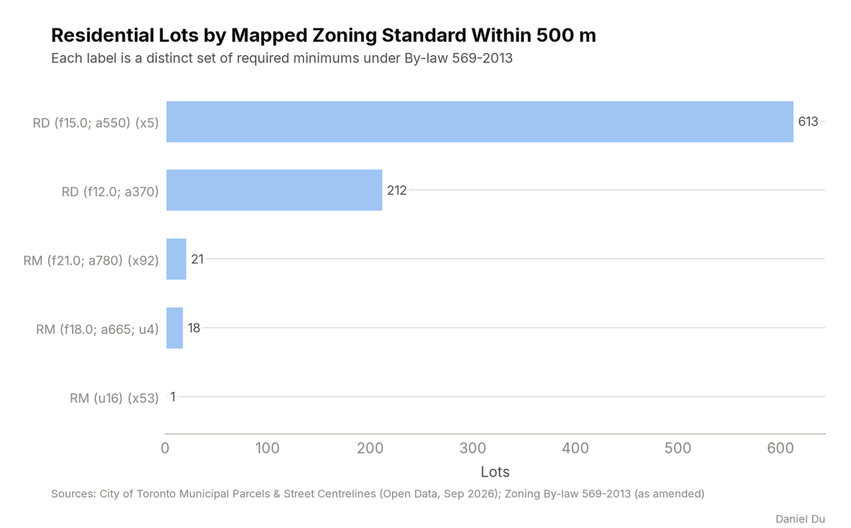
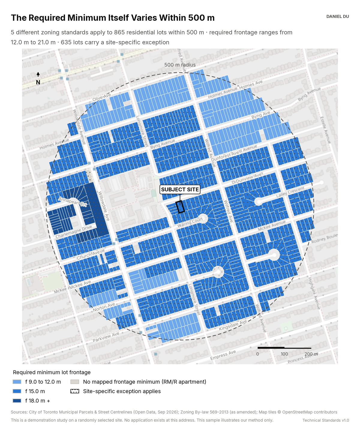
The study maps the required minimum standards. In one walkshed, the by-law map moves from f12.0 to f21.0.
5 different zoning standards apply within 500 m
The package includes the report (PDF), print-ready map and chart exhibits (PNG), the full data table with a data dictionary (CSV), a methods note (TXT).
The 2 km interactive map has the same controls and covers the full 2 km radius around the site.
How it is measured
We assign each residential lot to its zoning polygon with a point-in-polygon test against the Zoning Area layer of By-law 569-2013. The required minimum frontage is the 'f' value in the zone label. The required minimum area is the 'a' value. A trailing '(x n)' marks a site-specific exception. Lots with an exception are stippled on the map.
The map encodes required frontage as an ordered single-hue colour ramp. The ramp shows how far the paper standard itself moves within a five-minute walk. Zones with no mapped frontage minimum (apartment zones) are shown in grey.