Sample study · Neighbourhood character
Lot Frontage Pattern Study
The study measures the street frontage of every mid-block lot. It projects the frontage along the street line, so side lot lines never inflate it.
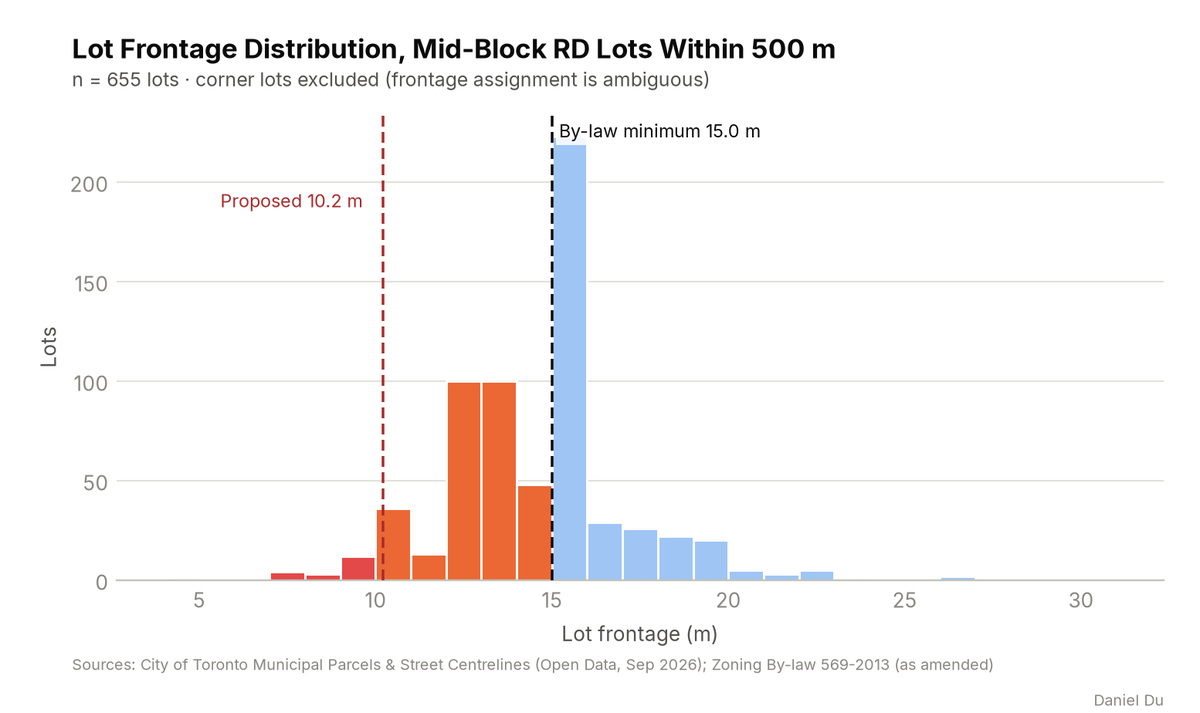
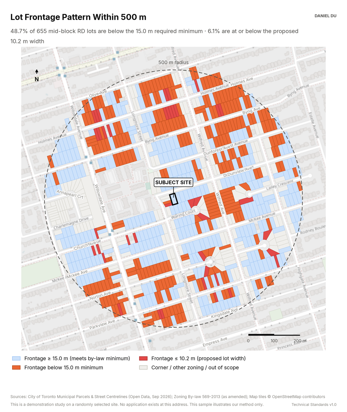
48.7% of mid-block lots are narrower than the 15.0 m minimum
The package includes the report (PDF), print-ready map and chart exhibits (PNG), the full data table with a data dictionary (CSV), a methods note (TXT), the interactive map (HTML).
The interactive map is one HTML file. Open it from disk in any browser. Each threshold has a slider and an exact-value box, and the counts and headline update as you move them. You can change the colours, outlines and fill, switch to a colour gradient, or add a satellite, topographic or building footprint background. Click any shaded lot to see its measured values. The map works offline. The satellite and topographic backgrounds need an internet connection. The package also includes this same file.
How it is measured
We compute frontage geometrically for every lot. First we identify the street-facing boundary of the lot against the City street centreline network. Then we measure the extent of that boundary as a projection onto the street direction. This method avoids two common errors in frontage tables. The first error is to read side lot lines into the frontage. The second error is to rely on assessment-roll frontages of unknown date.
We exclude corner lots from the statistics. Frontage assignment between the two streets of a corner lot is a legal interpretation. It cannot be measured from geometry alone. Corner lots are shown unshaded on the map. We also exclude road parcels, corridor parcels and unaddressed slivers.
The by-law minimum is the 'f' value in the zone label under Zoning By-law 569-2013. We class each lot against this minimum. We also class each lot against the width that the demonstration scenario proposes.